SCIENTIFIC RESEARCH EQUIPMENT
List of Scientific Research Equipment:
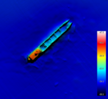
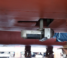
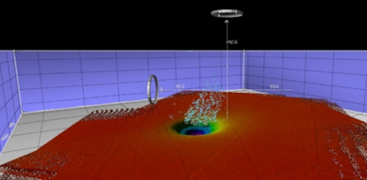
Multibeam echosounder (MBES) model SeaBat 7125 SV2
| Manufacturer: |
Teledyne Reson |
| Location Website: |
https://www.manualslib.com/products/Reson-Seabat-7125-Sv2-6921640.html |
| Room: |
r/v Oceanograf |
| Related disciplines of science: |
physical and geophysical sciences; hydrography; Earth and related environmental sciences |
| Keywords: |
multibeam echosoudner, MBES, bathymetry, bottom shape, backscatter, water column, identification of objects (e.g. wreck, UXO) |
| Description: |
The r/v Oceanograf is equipped with a SeaBat 7125 multibeam echosounder by Teledyne Reson. It can operate at two frequencies 200 and 400 kHz. The angular width of the transmitted beam for both frequencies, is 140°. The angular resolution of a single beam is 0.54°±0.03° x 1.1°±0.2° across and along the profile for 400 kHz and 1.1°±0.05° x 2.2°±0.5° for 200 kHz respectively. The maximum ping frequency reaches 50 Hz for both operating frequencies. The device is used in conjunction with other supporting devices: GPS RTK, IMU, gyro, SVP/CTD and works based on the Qinsy. Qimera and Fledermaus (QPS) software. |
| Application: |
Multibeam echosounder is a basic echosounder used in wide-angle seafloor observation techniques and provides information on the depths present in a given study area (bathymetry). MBES enables the collection of data from the water column (eg about fish stocks or the gas released from sediment) as well as provides information on the ‘hardness’ of the seabed and is used to distinguish between different types of seabed, such as hard rock or soft sediments through backscatter data registrations. The MBES echosoudner is also used to identify objects on the seabed. |
| Examples of research articles: |
DOI: 10.1016/j.scitotenv.2020.140306 |
| Manager of the laboratory: | Prof. Jarosław Tęgowski jaroslaw.tegowski@ug.edu.pl +48 58 523 68 24 |
| Person operating the equipment: | Jakub Idczak, PhD, Hydrographer cat. A (IHO) Jakub.idczak@ug.edu.pl +48 58 523 68 85 |
| Accessibility: | a) scientific research b) commercial activities c) education |
| Access rules |
Only used on r/v Oceanograf cruises |
 |
 |
 |
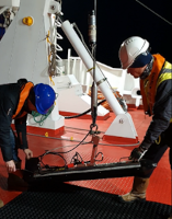
Side Scan Sonar (SSS) model 4200P
| Manufacturer: |
Edge Tech |
| Location Website: |
https://www.edgetech.com/wp-content/uploads/2019/07/0004842_Rev_P.pdf |
| Room: |
Institute of Oceanography, Gdynia |
| Related disciplines of science: |
physical and geophysical sciences; hydrography; Earth and related environmental sciences |
| Keywords: |
side scan sonar, SSS, backscatter, type of sediments, identification of objects (e.g. wreck, UXO) |
| Description: |
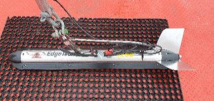
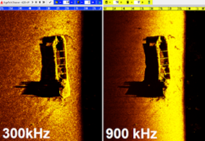
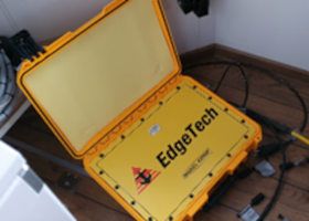
The sonar used in the survey on r/v Oceanograf is a cable towed side scan sonar model 4200P, produced by EdgeTech, operating at two frequencies: 300 and 900 kHz with a maximum ping rate of 12 ms and 3 ms – for 300 and 900 kHz respectively. When operating at 300 kHz, the device provides a data set at a lateral range of 230 m to port and starboard, while when operating at 900 kHz – the range reaches 75 m and the image has a higher resolution. The maximum depth at which the sonar can operate is 300 m. The sonar has a V-wing depressor that allows you to leave the sonar at a depth of min. 100 m. The device is used in conjunction with other supporting devices: GPS RTK, gyro, USBL and works based on the Qinsy (QPS), Discover (EdgeTech) and Sonar Wiz (Chesapeake Technology) software. |
| Application: |
Side scan sonar is used in hydroacoustic seabed detection methods to identify the nature of the seabed and types of surface sediments, as well as to locate anthropogenic objects lying on the seabed, collecting backscattering data. |
| Examples of research articles: |
DOI: 10.1016/j.scitotenv.2020.140306 |
| Manager of the laboratory: |
Jakub Idczak, PhD |
| Person operating the equipment: |
Jakub Idczak, PhD |
| Accessibility: |
a) scientific research |
| Access rules |
Used during cruises on various vessels |
 |
 |
 |
 |
Sub-bottom profiler (SBP) model 3100P with Towfish SB-216S
| Manufacturer: |
Edge Tech |
| Location Website: |
https://www.edgetech.com/wp-content/uploads/2019/07/0004802_Rev_F.pdf |
| Room: |
Institute of Oceanography, Gdynia |
| Related disciplines of science: |
physical and geophysical sciences; hydrography; Earth and related environmental sciences |
| Keywords: |
sub-bottom profiler, SBP, layers of bottom sediments |
| Description: |
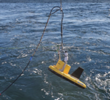
On board r/v Oceanograf there is a sub-bottom profiler model 3100P with TowFish SB-216S by EdgeTech. This device operates in the 2-16 kHz frequency range (chirp type). The towed fish is fitted with transducers and hydrophones mounted under an acoustic baffle inside the unit. Sediment penetration using the SB-216S ranges from about 6 m for coarse sands and gravels to about 80m for acoustically soft sediments (e.g. mud). The beam width ranges from 17° to 24° depending on the selected operating frequency range (17°: 2 – 15 kHz, 20°: 2 – 12 kHz, 24°: 2 – 10 kHz ). Depending on the operating mode, the device collects data with a vertical resolution of 6 to 10 cm. The maximum depth at which the SBP can operate is 300 m. The device is used in conjunction with other supporting devices: GPS RTK, gyro, USBL and works based on the Discover (EdgeTech) software. |
| Application: |
A sub-bottom profiler is a hydroacoustic device used in shallow seismic surveys. The SBP is used for mapping of seabed structures, including: i) geological recognition of the bottom sediments that build the seabed; ii) search for sand deposits – determination of the thickness of the sand bed and the extension of its layers; iii) recognition of ground conditions for the construction of hydro-technical structures; iv) planning of routes of benthic pipelines and cables. |
| Examples of research articles: |
DOI: 10.1016/j.scitotenv.2020.140306 |
| Manager of the laboratory: |
Jakub Idczak, PhD |
| Person operating the equipment: |
Dominik Pałgan, PhD |
| Accessibility: |
a) scientific research |
| Access rules |
Used during cruises on various vessels |
 |
 |
 |
Split-beam echosounders model EK80 (38 kHz, 120 kHz and 333 kHz)
| Manufacturer: |
Simrad |
| Location Website: |
https://ngdc.noaa.gov/mgg/wcd/simradEK80manual.pdf |
| Room: |
r/v Oceanograf |
| Related disciplines of science: |
biological and physical sciences; Earth and related environmental sciences |
| Keywords: |
split-beam echosounder, abundance esstimation, fish biomass, fish migration, target strength, TS |
| Description: |
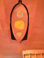
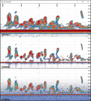
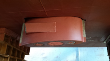
The Simrad EK80 is the most modern “high end” split beam scientific echo sounder in the fishery scientific. The r/v Oceanograf vessel has three split-beam echosounders model EK80 with the 38 kHz, 120 kHz and 333 kHz transducers. The device is used in conjunction with other supporting devices: GPS, IMU, gyro, SVP/CTD and works based on the EK80 (Simrad) software. |
| Application: |
The split-beam echosounders are used to estimate the biomass of fish or track thei migration. These echosounders can also be used to observe escaping gas from the seabed sediments into the water column. |
| Examples of research articles: |
DOI: 10.1016/j.scitotenv.2020.140306 |
| Manager of the laboratory: |
Jakub Idczak, PhD, Hydrographer cat. A (IHO) |
| Person operating the equipment: |
Karolina Trzcińska, MSc |
| Accessibility: | a) scientific research b) commercial activities c) education |
| Access rules |
Only used on r/v Oceanograf cruises |
 |
 |
 |
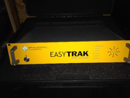
Ultra-short baseline system (USBL) model EASYTRAK Nexus
| Manufacturer: |
Applied Acoustics |
| Location Website: |
https://www.subseatechnologies.com/media/files/files/167d609c/EZT-2690-8000-8_Easytrak_Nexus_Operator_Manual.pdf |
| Room: |
r/v Oceanograf |
| Related disciplines of science: | physical and geophysical sciences; hydrography; Earth and related environmental sciences |
| Keywords: |
Ultar-short baseline, USBL, underwater navigation |
| Description: |
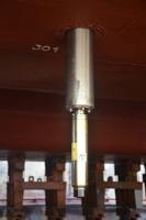
The Easytrack Nexus hydroacoustic transducer is located in the starboard hull of the catamaran. During operation, the transducer is extended below the keel by a hydraulic outrigger to a distance of about 1 m while maintaining horizontal visibility of 360°. The USBL head’s lowering/lifting system allows the transducer to be inspected both at sea and in port, without the need to dock the vessel, and the transducer can be safely stowed inside the hull for the duration of the survey. The device works with the following systems: GPS RTK, IMU, ROV, SBP, SSS and Qinsy (QPS) software. |
| Application: |
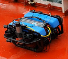
We use the USBL underwater navigation system, model Easytrack Nexus by Applied Acoustics, when we work with data recording devices while towing them behind the vessel (such as Side Scan Sonar, Sub-bottom profiler), or others requiring underwater navigation while conducting underwater target inspection such as Remotely operated underwater vehicles (ROV). |
| Examples of research articles: |
DOI: 10.1016/j.scitotenv.2020.140306 |
| Manager of the laboratory: |
Prof. Jarosław Tęgowski |
| Person operating the equipment: |
Jakub Idczak, PhD, Hydrographer cat. A (IHO) |
| Accessibility: |
a) scientific research |
| Access rules |
Only used on r/v Oceanograf cruises |
 |
 |
 |
Acoustic doppler current profiler (ADCP) model Workhorse Mariner (600kHz)
| Manufacturer: |
Teledynie RD Instruments |
| Location Website: |
https://www.comm-tec.com/Prods/mfgs/rdi/manuals/Monitor%20User%20Guide.pdf |
| Room: |
r/v Oceanograf |
| Related disciplines of science: |
physical and geophysical sciences; hydrography; Earth and related environmental sciences |
| Keywords: |
ADCP, acoustic doppler current profiler, speed and direction of sea currents |
| Description: |
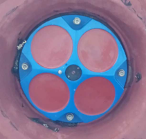
The ADCP is located in the port hull of the ship near the bow. 4-beam transducer works at 600kHz frequency, operating range up to 70m. The Mariner is an accurate, rapid sampling current profiling system designed to operate from a moving boat. The unit is easily integrated into the vessel’s DGPS input to provide integrated ADCP readings with precise position information. The device works with the following systems: GPS RTK, IMU and Qinsy (QPS) software. |
| Application: |
An Acoustic Doppler Current Profiler (ADCP) measures the vertical distribution of the water speed as well as the direction of the current. |
| Examples of research articles: |
|
| Manager of the laboratory: |
Jakub Idczak, PhD, Hydrographer cat. A (IHO) |
| Person operating the equipment: |
Jakub Idczak, PhD, Hydrographer cat. A (IHO) |
| Accessibility: |
a) scientific research |
| Access rules |
Only used on r/v Oceanograf cruises |
 |
 |
Gyrocompass and motion sensor (IMU) model OCTANS
| Manufacturer: |
iXblue |
| Location Website: | |
| Room: |
r/v Oceanograf |
| Related disciplines of science: |
physical and geophysical sciences; hydrography; Earth and related environmental sciences |
| Keywords: |
Inertail Measurement Unit, IMU, Motion Referense Unit, MRU |
| Description: |
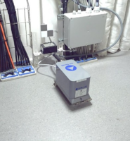
For the smooth operation of measurement systems that require information on the roll, pitch, heave and heading of the vessel during measurements – such as e.g. MBES, USBL an OCTANS Surface model inertial measurement unit (IMU) was also installed on board. The unit was placed at the ship’s Center of Gravity (CoG). The accuracy of installed angle measurements is < 0.03° for Heading and 0.001° for Roll and Pitch. The device works with the following systems: MBES, split-beam, USBL. |
| Application: |
Used in work with devices that require information about the roll, pitch, heave and heading of the vessel during measurements. |
| Examples of research articles: |
DOI: 10.1029/2019EA000983 |
| Manager of the laboratory: |
Prof. Jarosław Tęgowski |
| Person operating the equipment: | |
| Accessibility: | a) scientific research b) commercial activities |
| Access rules |
Only used on r/v Oceanograf cruises |
 |
Trimble SPS 855 modular GPS RTK receiver with ZEPHYR Model 2 Rugged antenna
| Manufacturer: |
Trimble |
| Location Website: |
https://www.sitech-japan.com/stj/file/solutions/022482-2508C_SPS855_DS-USL_072916.pdf |
| Room: |
r/v Oceanograf |
| Related disciplines of science: | different types of research |
| Keywords: |
GPS RTK |
| Description: |
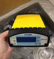
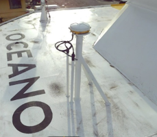
TThe RTK (real-time kinematic) GPS (global positioning system), including a Trimble SPS855 modular receiver with a Trimble ZEPHYR Model 2 Rugged GNSS antenna, is used to position the vessel as well as the sensors of the measurement equipment on board r/v Oceanograf using position corrections transmitted from EUPOS/SAPOS systems via an internet connection. The system provides information about geographical coordinates, which are necessary to determine the location of the place of measurement. By dint of the applied solution it is possible to obtain high position accuracy, depending on the access to DGPS, RTK corrections. In the case of access to the RTK corrections the accuracy of the horizontal position can even be below 1 cm, while for the vertical position – below 2 cm. |
| Application: |
Vessel GPS system. |
| Examples of research articles: |
|
| Manager of the laboratory: | Prof. Jarosław Tęgowski jaroslaw.tegowski@ug.edu.pl +48 58 523 68 24 |
| Person operating the equipment: | |
| Accessibility: | a) scientific research b) commercial activities |
| Access rules |
Only used on r/v Oceanograf cruises |
 |
 |
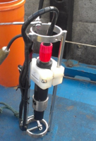
Sound Velocity Profiler (SVP) model miniSVP
| Manufacturer: |
Valeport |
| Location Website: |
https://www.valeport.co.uk/content/uploads/2021/07/0660880e-miniSERIES-Operating-Manual.pdf |
| Room: |
r/v Oceanograf |
| Related disciplines of science: | physical and geophysical sciences; hydrography; Earth and related environmental sciences |
| Keywords: |
SVP, Sound Velocity Profiler/Probe, SVS, Sound Velocity Sensor |
| Description: |
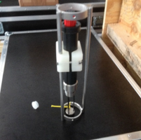
Using its internal batteries, this device operates autonomously and starts up immediately after being dropped into the water. Measurements are made at a preset depth step and are triggered as the probe is lowered to the bottom of the body of water. Used in research with hydroacoustic devices. |
| Application: |
Valeport’s miniSVP provides direct measurement of the speed of sound in a column of water. Often used in working with hydroacoustic devices. |
| Examples of research articles: |
|
| Manager of the laboratory: |
Prof. Jarosław Tęgowski |
| Person operating the equipment: |
Karolina Trzcińska, MSc |
| Accessibility: |
a) scientific research |
| Access rules |
Used during cruises on various vessels |
 |
Conductivity/Teperature/Depth Profiler (CTD) model miniCTD
| Manufacturer: |
Valeport |
| Location Website: |
https://www.valeport.co.uk/content/uploads/2021/07/0660880e-miniSERIES-Operating-Manual.pdf |
| Room: |
r/v Oceanograf |
| Related disciplines of science: |
different types of research |
| Keywords: |
SVP, Sound Velocity Profiler/Probe, SVS, Sound Velocity Sensor |
| Description: |
Technical data: Used in many oceanographic studies, including work with hydroacoustic devices. |
| Application: |
Valeport’s miniCTD Profiler is used to directly measure conductivity, pressure and temperature in the water column. These parameters are also used to calculate (indirectly) water salinity, density as well as the value of the speed of sound in the water column, which is a critical parameter when working with the hydroacoustic equipment installed on the r/v Oceanograf ship. |
| Examples of research articles: |
DOI: 10.1016/j.scitotenv.2020.140306 |
| Manager of the laboratory: |
Maciej Matciak, PhD |
| Person operating the equipment: |
Maciej Matciak, PhD |
| Accessibility: |
a) scientific research |
| Access rules |
Used during cruises on various vessels |
 |
